[27 May 2015 update: We are extremely grateful to accept a Project Accelerator Grant from Make Something Edmonton for this project! However, we are switching our attention to a different location, due to permit problems with the original site. Please read on for the details of our revised project on the new site.]
[12 June update: We now have a Facebook event page! Also, we're modifying our plans slightly. Look for the crossouts and text in purple below to see how we've changed things.]
[5 July update: I've posted some tips based on what I learned and a Storify of all the #DIYcity over on The Local Good's blog!]
 |
| (sign created by our collaborator Green Spectacle Creations) |
We want to create a pop-up adventure playground and transitory community-created art installation to animate Rabbit Hill Natural Area for #DIYCity Day. (Here's our Make Something Edmonton project page.) Won't you help us use the ideas of tactical urbanism to create a family-friendly suburban event?
Who: We're an as-yet-unnamed collective of artists looking for collaborators and volunteers to make this thing happen. (If that's you, please leave a comment below and I will get in touch!) We are passionate about creating a series of pop-up play places in both urban and suburban neighborhoods that activate underused or lost public spaces and create feelings of community connectedness. We see Highest Point as the first installation in a series.
What: Highest Point Pop-Up Playground will be a pop-up adventure playground, transitory community-created art installation (chalk and wheatpaste), and textile art installation in the parkland surrounding the highest point in Edmonton, a glacial kame called Rabbit Hill. It will be paired with a temporary slide [our special events liability insurance people advised we lose this idea] down the grassy steep slope on the north side of the kame, and a mix of temporary and permanent wayfinding and interpretative signs along the paths that help people explore the area while informing them about the kame's cultural and natural history, and a temporary Heart Garden (in collaboration with Reconciliation In Solidarity Edmonton). We plan to use wayfinding, art, and playhouse creation to help foster connection with the natural and material history of the place. We hope to reclaim the kame's historical importance as a site with thousands of years of Indigenous use, and foster social investment in the kame with the nature reserve as a focal point.
When: June 21st (#DIYCity and National Aboriginal Day), 10am to 6pm
Where: The highest point in Edmonton, at 716m, is at the southern end of parkland on a glacial kame called Rabbit Hill in the suburban Magrath neighborhood in southwest Edmonton. [Rabbit Hill is NOT the ski hill!] The park is located at 53.449715, -113.559655 on Google Maps; you can see the recently-built playground at the northern base of the kame, a grassy area that will probably be used to enlarge the playground with a spray deck on the west, and an area with a couple of benches and a picnic table on the east, on Google Streetview from the intersection of Magrath Road and Magrath Boulevard. Just uphill of the playground is a bowl-shaped grassy area (ideal for the pop-up playground made of recyclables and our other planned activities) at the base of a steep slope the local kids like to use for tobogganing in winter. At the top of the hill is the wooded area set aside as a nature reserve, with gravel or grass walking paths around its perimeter and a dirt trail running through it.
 |
| The playground at the north end of the kame in Magrath (Heights) Park is about two years old. Take the grey gravel path up the hill... |
 |
| ...and you will find a bowl-shaped area covered in sod and a pretty great sledding hill. The grassy field will be the area where we'll be playing and making art together. |
 |
| The plantings around the sign at the top of Rabbit Hill have all been nibbled to the ground by local wildlife. This is where we'll plant our Heart Garden for the day; the hearts will then be moved to join RISE's longer-term installation downtown. The trailhead is located between the sign and the two benches. The textile art installation (a surprise!) will mark the trailhead. |
 |
| There was haze from the forest fires, but as you can see, there's a pretty nice of view of downtown Edmonton from the north side of the glacial kame, where the two benches have been placed. Before settlement, this hill was used as a lookout area for tracking the movement of buffalo, and probably also the arrival of other bands at Pehonan to trade. |
 |
| Southside skyscrapers block the view of the Legislature grounds, but you can make out some of the construction cranes... |
 |
| ...and the buildings in the east end of downtown are definitely identifiable. |
The park has several other names: Magrath Park or Magrath Heights Park, which properly refer to the playground area, and the Southwest Highland Natural Area (SW86) or Rabbit Hill Natural Area, which refer to the ecologically unique area maintained as a municipal reserve at the top of the kame. (The number of official names the space has had is itself a reflection of the loss of its historical significance.)
The City of Edmonton explains at this link, and in detail in this report (PDF, pages 7-8), the ecological significance of Southwest Highland / Rabbit Hill Natural Area due to its proximity to Whitemud Creek Ravine, its creation by glacial deposition, and its partial clearance during agricultural use. That natural history can easily be incorporated into our educational pop-up playground activites and wayfinding signage.
 |
| Looking back at the North-end trailhead. The nature reserve area is deciduous forest, primarily thickets of trembling aspen, with lots of open clearings, but also includes an area that was cleared by farmers and is now showing succession forest species. There's lots of wild rose, raspberry, saskatoon, snowberry, and beaked hazelnut among the understory species. |
After settlement by mainly German and Ukrainian immigrants in the 1890s, the first school and church in the area were built within a mile of Rabbit Hill and took their names from it. The area was converted to farmland, with coal mining near Whitemud Creek Ravine to the south of Rabbit Hill. The post-settlement history of the area will also be incorporated into the educational pop-up playground activities [a photo scavenger hunt!] and wayfinding signage.
 |
| We found this gem of a map showing the location of the first school and church in the area, names of settlers, and names of the coal mines in the southern part of Whitemud Creek Ravine! It's from a rare book called South Edmonton Saga, compiled in the early 1980s by local residents, that's in the special collections at the Edmonton Archives (where we found it) and the Stanley A. Milner branch of Edmonton Public Library. |
Nearby developers (see Larch Park's Larch Sanctuary website and page 8 of their interpretive program (PDF)) and archaeologist Heinz Pyszczyk (subscription required) have quietly noted Rabbit Hill's Indigenous significance as a lookout point and intermittent camping site, for perhaps as long as 12,000 years. Rabbit Hill Natural Area may hold archaeological sites on its crown, which hasn't been excavated, and has already yielded thousands of artifacts from its slopes during pre-development excavation. This long history of Indigenous use seems not to be widely known.
 |
| This grove of trembling aspen near the highest point in Edmonton holds a secret. |
 |
| This was a wonderful surprise: a tipi, complete with hearth and east-facing door opening, hiding in the aspen grove. |
Since last summer, someone has built this slightly-damaged tipi in an aspen grove on the crown of Rabbit Hill. It's not clear from the site whether city permission was sought for this structure (it seems unlikely)[update: we're told that someone has built a series of these without permission on parkland, and that it shouldn't be touched]. However, given the deep history of Indigenous use of Rabbit Hill, we'd like to collaborate with local aboriginal and Metis groups to fix and use the structure during our event as a focal point for ceremony, education, and reconciliation - perhaps through a community-created art installation, or through ceremonial use of the site and creation of Ribbon Trees.
...we will also be working long-term for the creation of a Rabbit Hill Advisory Council with local Indigenous and Metis groups. The Advisory Council may discuss creation of a permanent structure or art installation as a focal point for ceremony, education, and reconciliation; installation of permanent signage including the Cree and Blackfoot name(s) for Rabbit Hill; and/or other projects that will promote knowledge and understanding of Rabbit Hill's significance. [Update: we recognize that a Rabbit Hill Advisory Council initiative is best framed as a partnership with the local community league that is *led by* local Indigenous and Metis groups, who presently have other long-term projects with similar aims in the works in more central locations in our region, so we're viewing this as a very-long-term goal.]
 |
| It's difficult to tell with my camera's focus and the hazy air, but the view at the south end of the glacial kame includes the Anthony Henday Freeway and the farmland beyond. |
 |
| This tiny surveyor's stake at the south end of the kame marks the highest point in Edmonton (elevation 716m). How anticlimactic. Let's do something really cool for this spot [without moving the stake or disturbing the ground!] |
Why: By creating a common focus (creative play) in an unusual setting, barriers between community members can be dissolved in a low-stakes but intentional way, and neighborhood identity can be discovered. In newly built suburban neighborhoods, this process can be especially helpful in giving community members a sense of belonging and engagement that we hope will encourage civic identity and involvement.
This site is also rich with aboriginal history and significance that has gone practically unacknowledged to date, so we see a unique opportunity to reclaim and celebrate that significance as an important step toward reconciliation.
 |
| View of Rabbit Hill Natural Area from the bottom of the hill, at the entrance to the eastern access path on Magrath Boulevard. |
 |
| The view east, and a groomed gravel walking path downhill that connects with the top-of-ravine multiuse path. |
 |
| The south-end access stairway, where Macneil Link meets Macneil Way. |
 |
| View from the top of the south stairs. |
 |
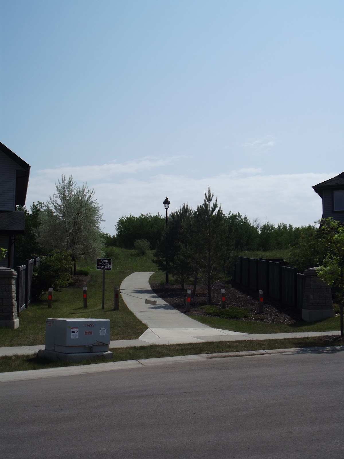
| The western access path into Rabbit Hill Natural Area on Malone Way is marked with stone pillars. |
 |
| The view west from the top of the kame, including a stone pillar marking the western entrance. This area was cleared by farmers and is visible as a driveway on older aerial photos. |
We'd be remiss if we didn't acknowledge our partners:
 |
| Pop-Up Adventure Play are fantastic! If you want to create a space for kids to engage in self-directed creative play using recycled materials, similar to ours, we highly recommend you sign up for their helpful, free resource packages. |
 |
| You owe it to yourself to create a project page for your super-cool side project on Make Something Edmonton's website. It's an amazing way to find collaborators and resources and reach a different audience with your promotion. We're grateful to acknowledge that we've received a Project Accelerator Grant from Make Something Edmonton to cover the materials costs for this pop-up event. |


No comments:
Post a Comment